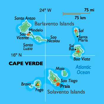
Its transfers this next Sunday, so it should be pretty fun:). We are going to zone conference on Mindelo, Sao Vicente, (see map below), today and we will be there till quarta-feira (Wednesday). It's supposed to be really cool!
This week was a really normal week, we just taught lessons, so nothing crazy happened. We've eaten some strange food here, but mostly chicken. They have something called Cachupa, (see below), here. It pretty good. Its made out of whatever things they want to. You have to be careful sometimes, because they like to put whisky in everything ha ha:) .
The weather here is the same everyday: sunny and hot. The language is hard right now and I'm not picking up very much, but things will get better:).
It's funny to think that in one month, 1/8th of my mission will be done. It doesn't feel like that at all, its gone by soooooo fast!
Well, that's about it for the weekly report. I hope everything is going well for you all and glad you are all having fun!:)
Love Elder Stratton
Cachupa (Portuguese pronunciation: [kɐˈʃupɐ]) is a famous dish from the Cape Verdeislands, West Africa. This slow cooked stew of corn (hominy), beans, and fish or meat(sausage, beef, goat or chicken) is often referred to as the country's national dish.[1]Each island has its own regional variation. It is a hearty dish, and may even be served reheated at breakfast.

***See video of how to make Cachupa by: ***
Highlight and right click on this link:
www.youtube.com/watch?v=Wd0Q9DzHIdk
then click on
"Go to www.youtube.com/watch?v=Wd0Q9DzHIdk" .
Watch the video and Enjoy!!! It's dated 18.1.2013.
~~~~~~~~~~~~~~~~~~~~~~~~~~~~~~~~~
A little about where Elder Stratton will be spending the next couple of days! (from Wikipedia)
São Vicente (Portuguese for "Saint Vincent"), also Son Visent or Son Sent in Cape Verdean Creole, is one of the Barlavento islands of Cape Verde.
The island is roughly rectangular in shape with a surface area of ca. 227 km2 (88 sq mi). From east to west it measures 24 km (15 mi) and from north to south no more than 16 km (9.9 mi). The terrain includes mountains in the west, the southwest, the south, the east-central and the north. The area is flat in the north-central, the central part, the eastern part south of Calhau and the northern part in the Baía das Gatas area. The urban area of Mindelo is in the northern part. Much of the island is deforested.
Although volcanic in origin, the island is quite flat. Its highest point is Monte Verde(Portuguese for green mountain) located in the northeast-central part with an altitude of 725 metres (2,379 ft). Although a great amount of erosion has taken place, some craters still remain — in particular near the bay of Mindelo. Other mountaintops include Monte Cara and Topona.
São Vicente was discovered on Saint Vincent's Day (January 22) in 1462. Due to its lack of water, the island was initially used only as a cattle pasture by some proprietors of the neighboring island of Santo Antão. The island remained practically uninhabited until the middle of the 19th century. It was only in 1838, when a coal deposit was established in Porto Grande to supply ships on Atlanticroutes, that the population started to grow rapidly. Due to the lack of rain and consequent lack of natural resources, the economy of São Vicente is based mainly on commerce and services.
The population of São Vicente in the 2010 census was 76,107 of which 5,639 are rural. It is the second most populous island of Cape Verde. The annual population growth is around 1.3% (higher than the state (national) level of 1.2%). 92.6% of the population live in urban areas, higher than the Cape Verde's level of 61.8% and is the highest in all of Cape Verde. Life expectancy is 70,4 for males and 78 for females, higher than some other parts of the world. The birth rate is 2.7% and infant mortality rate is 21 per 1000 live births[1] (for comparison 103 in DR Congo, 55 in India, 27 in Turkey, 23 in Brazil, 16 in Russia, 4 in Finland).
The majority of the population is young; 66% of the population is under the age of 30, and 8.6% of the population is over the age of 60. The island has 16,000 families, of which there are an average of 3,6 persons per household, lower than Cape Verde's level of 3,9 persons per household. 56% of the families live in houses, the other 30% live in poorly-built houses.
About only 11% of the families own automobiles, which is 7.4% of Cape Verde's level.
The economy of the island was always based almost exclusively on commerce and services. Due to lack of rain, agriculture is at a subsistence level. Fishing has some relevance, but conditions prevent it from being more important, not only for the catch — lobster — but also for the associated industries: conserves, drying and salting of fish, and naval construction.
The literacy rate is 85%, and 98.9% among Cape Verdean youth. 54% of the island's population (those aged between 1 and 12 year old) receive education.
Portuguese which is the primary language, Cape Verdean Creole is mainly spoken by the majority of the population. The São Vicente variant is known as Crioulo de São Vicente (in Portuguese) or Kriol d Sonsent (in Creole).
No comments:
Post a Comment